Button CopyPathCircle CloseCircle Left ArrowArrow Down Icon GreyClosecirclecircleBurger
  • Advertising

Hwy 5, Rural Cardston County, AB, T0K 0A0

MLS® # A2271352
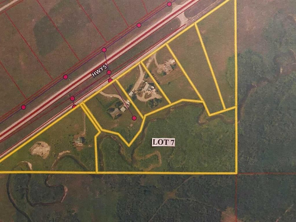
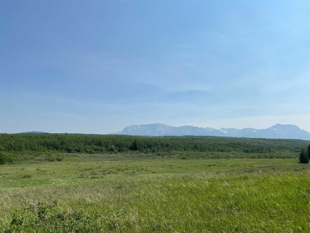
Vacant Land For Sale In Rural Cardston County, Alberta
$375,000

None Beds

Hwy 5, Rural Cardston County, AB
  • Advertising
Hwy 5, Rural Cardston County, AB, T0K 0A0
$375,000

Property Information:

9+ acres of land is immediately east of Waterton Lakes National Park. This unique property incorporates Crooked Creek from one end to the other and is bordered by Nature Conservancy and agricultural terrain on the remainder. Various locations to build. This will require a road between Lots 5 and 6 (not yet established) and an access bridge to the land. GST is applicable. No time requirement to build. Please obtain permission to walk the acreage.

Inclusions: N/A

Property Features:

  • Lot Size: 395089.00 Square Feet
  • Water Source: Other
  • Zoning: CR1

Courtesy of: SUTTON GROUP-LETHBRIDGE CROWSNEST PASS BRANCH

Data provided by: Lethbridge And District Association Of REALTORS® 516 6 St. S, Lethbridge, Alberta T1J 2E2
All information displayed is believed to be accurate but is not guaranteed and should be independently verified. No warranties or representations are made of any kind. Copyright© 2021 All Rights Reserved

Location of Hwy 5, Rural Cardston County, AB, T0K 0A0

Climate Risk Data

About Climate Risk: Properties are at increased risk of damage from extreme weather due to climate change.
ClimateCheck provides detailed climate risk data for properties now and up to 30 years into the future.

Projected Heat Risk: Moderate

31 hot days expected in 2050

Projected Precipitation Risk: Moderate

12 storms expected in 2050

Projected Heat Risk: Moderate

31 hot days expected in 2050

41/100

Moderate

ClimateCheck®

Current data

This property, Hwy 5 , experiences 7 hot days per year at around 28.1 degrees Celsius.

Projected data

Severe heat risk is expected to increase in this area. In 2050, it is projected that there will be 31 hot days at 32.3 degrees Celsius.

Projected Avg. Temperature

Past
28.1℃
2050
32.3℃

# Hot Days Per Year

Past
7
2050
31

About Heat Risk

Heat risk is the number of extreme heat days experienced each year looking at historical conditions (1980-2005) in your area and taking the 2% of the hottest days and projecting that into the future.

Projected Precipitation Risk: Moderate

12 storms expected in 2050

47/100

Moderate

ClimateCheck®

Current data

This property, Hwy 5 , experiences 11 significant 2-day storms per year, with about 297.6mm of precipitation per storm.

Projected data

Severe storms are expected to increase in this area. In 2050, it is projected that there will be 12 significant 2-day storms with 334.2mm of precipitation per year.

Precipitation Per Storm

Past
297.6mm
2050
334.2mm

48-Hour Storms Per Year

Past
11
2050
12

About Storm Risk

Storm risk is the number of high wind, wet or snowy events each year. Climate check looks at historical conditions (1980-2005) in your area, on the days with the top 1% of total precipitation in a year and projected to 2050.

Climate risk data is provided for informational purposes only on Royallepage.ca.
If you have questions or feedback about this data, get help at climatecheck.com.

Environmental Risks provided by ClimateCheck®

Royal LePage does not endorse nor guarantee this information. By providing this information, Royal LePage and its agents are not providing advice or guidance on climate risks. Royal LePage strongly recommends that consumers independently investigate the property’s climate risks to their own personal satisfaction.