Button CopyPathCircle CloseCircle Left ArrowArrow Down Icon GreyClosecirclecircleBurger

13476 HIGHWAY 542, Gore Bay, Manitoulin Island, Ontario, P0P 1H0

MLS® # 2112862
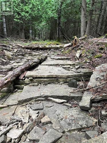
Vacant Land For Sale In Gore Bay, Manitoulin Island, Ontario
$205,000
13476 Highway 542, Gore Bay, Manitoulin Island, ON
  • Advertising
ACTIVE
13476 HIGHWAY 542, Gore Bay, Manitoulin Island, Ontario, P0P 1H0
$205,000

Property Information:

Just under 25 acres of mixed bush on Highway 542 is up for sale! Only 10 minutes from the Town of Gore Bay, this ideal hunting property has 2 hunting stands included in the sale. The property features a mixed bush, a cut trail surrounding the perimeter of the property, and lots of Manitoulin flag stone! The property also features a natural spring that runs in the early spring. Perfect for hunting, or building a country home! (id:7525)

Property Features:

  • OwnershipType: Freehold
  • Property Type: Vacant Land
  • Access Type: Year-round access
  • Amenities Nearby: Golf Course, Highway, Schools, Shopping
  • Community Features: Family Oriented, Quiet Area, Rural Setting, School Bus
  • Fence Type: Not fenced
  • Irregular: Yes
  • Lot Size: 829 X IRREG
  • Road Type: Paved road
  • Soil Type: Mixed soil, Stones
  • Zoning: R
  • Parking Type: None

REALTOR.ca  

Location of 13476 HIGHWAY 542, Gore Bay, Manitoulin Island, Ontario, P0P 1H0

Climate Risk Data

About Climate Risk: Properties are at increased risk of damage from extreme weather due to climate change.
ClimateCheck provides detailed climate risk data for properties now and up to 30 years into the future.

Projected Heat Risk: High

34 hot days expected in 2050

Projected Storm Risk: High

13 storms expected in 2050

Projected Heat Risk: High

34 hot days expected in 2050

46/100

High

ClimateCheck®

Current data

This property, 13476 HIGHWAY 542 , experiences 7 hot days per year at around 27.8 degrees Celsius.

Projected data

Severe heat risk is expected to increase in this area. In 2050, it is projected that there will be 34 hot days at 31 degrees Celsius.

Projected Avg. Temperature

Past
27.8℃
2050
31℃

# Hot Days Per Year

Past
7
2050
34

About Heat Risk

Heat risk is the number of extreme heat days experienced each year looking at historical conditions (1980-2005) in your area and taking the 2% of the hottest days and projecting that into the future.

Projected Storm Risk: High

13 storms expected in 2050

57/100

High

ClimateCheck®

Current data

This property, 13476 HIGHWAY 542 , experiences 11 significant 2-day storms per year, with about 296.2mm of precipitation per storm.

Projected data

Severe storms are expected to increase in this area. In 2050, it is projected that there will be 13 significant 2-day storms with 378.7mm of precipitation per year.

Precipitation Per Storm

Past
296.2mm
2050
378.7mm

48-Hour Storms Per Year

Past
11
2050
13

About Storm Risk

Storm risk is the number of high wind, wet or snowy events each year. Climate check looks at historical conditions (1980-2005) in your area, on the days with the top 1% of total precipitation in a year and projected to 2050.

Climate risk data is provided for informational purposes only on Royallepage.ca.
If you have questions or feedback about this data, get help at climatecheck.com.

Environmental Risks provided by ClimateCheck®

Royal LePage does not endorse nor guarantee this information. By providing this information, Royal LePage and its agents are not providing advice or guidance on climate risks. Royal LePage strongly recommends that consumers independently investigate the property’s climate risks to their own personal satisfaction.

Demographic Information of 13476 HIGHWAY 542, Gore Bay, Manitoulin Island, Ontario, P0P 1H0

Life Stage

Families with Tweens

Employment Type

Mixed

Average Household Income

$92,000.00

Average Number of Children

1.60

Household Population

Household Structure

Age of Population

Education

Education Level

No certificate/diploma/degree

25.51 %

High school certificate or equivalent

34.69 %

Apprenticeship trade certificate/diploma

2.04 %

College/non-university certificate

18.37 %

University Degree

14.28 %

Commuter

Travel To Work

By Car

80.0 %

By Public Transit

0.0 %

By Walking

16.67 %

By Bicycle

0.0 %

By Other Methods

3.33 %

Cultural Diversity

Knowledge of Official Language

Mother Tongue

Building Information

Building Type

Apartments (Low and High Rise)

Houses

100.0 %

Own Vs. Rent