Button CopyPathCircle CloseCircle Left ArrowArrow Down Icon GreyClosecirclecircleBurger

5 WEST HARRIS ROAD, Brant, Ontario, N3T 5L4

MLS® # X8046748
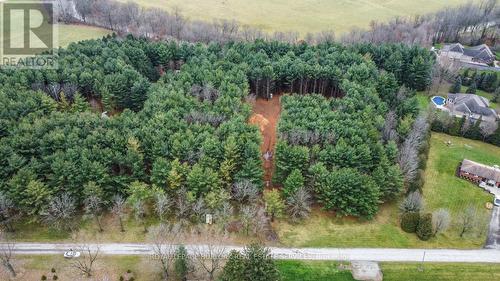
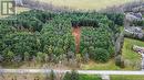
Vacant Land For Sale In Brant, Ontario
$1,488,000
5 West Harris Road, Brant, ON
  • Advertising
ACTIVE
5 WEST HARRIS ROAD, Brant, Ontario, N3T 5L4
$1,488,000

Property Information:

Quiet rural setting on the outskirts of Brantford - nearly 3 acres of treed land backing onto Fairchild creek. (id:27)

Property Features:

  • Property Type: Vacant Land
  • Irregular: Yes
  • Lot Size: 278 x 524 FT
  • Sewer: Septic System

REALTOR.ca  

Location of 5 WEST HARRIS ROAD, Brant, Ontario, N3T 5L4

Climate Risk Data

About Climate Risk: Properties are at increased risk of damage from extreme weather due to climate change.
ClimateCheck provides detailed climate risk data for properties now and up to 30 years into the future.

Projected Heat Risk: High

33 hot days expected in 2050

Projected Storm Risk: Very High

14 storms expected in 2050

Projected Heat Risk: High

33 hot days expected in 2050

52/100

High

ClimateCheck®

Current data

This property, 5 WEST HARRIS ROAD , experiences 7 hot days per year at around 31.5 degrees Celsius.

Projected data

Severe heat risk is expected to increase in this area. In 2050, it is projected that there will be 33 hot days at 35.1 degrees Celsius.

Projected Avg. Temperature

Past
31.5℃
2050
35.1℃

# Hot Days Per Year

Past
7
2050
33

About Heat Risk

Heat risk is the number of extreme heat days experienced each year looking at historical conditions (1980-2005) in your area and taking the 2% of the hottest days and projecting that into the future.

Projected Storm Risk:

14 storms expected in 2050

61/100

ClimateCheck®

Current data

This property, 5 WEST HARRIS ROAD , experiences 11 significant 2-day storms per year, with about 313.4mm of precipitation per storm.

Projected data

Severe storms are expected to increase in this area. In 2050, it is projected that there will be 14 significant 2-day storms with 387.5mm of precipitation per year.

Precipitation Per Storm

Past
313.4mm
2050
387.5mm

48-Hour Storms Per Year

Past
11
2050
14

About Storm Risk

Storm risk is the number of high wind, wet or snowy events each year. Climate check looks at historical conditions (1980-2005) in your area, on the days with the top 1% of total precipitation in a year and projected to 2050.

Climate risk data is provided for informational purposes only on Royallepage.ca.
If you have questions or feedback about this data, get help at climatecheck.com.

Environmental Risks provided by ClimateCheck®

Royal LePage does not endorse nor guarantee this information. By providing this information, Royal LePage and its agents are not providing advice or guidance on climate risks. Royal LePage strongly recommends that consumers independently investigate the property’s climate risks to their own personal satisfaction.