Button CopyPathCircle CloseCircle Left ArrowArrow Down Icon GreyClosecirclecircleBurger

0 14N Road, Woodridge, Manitoba, R0A 2N0

MLS® # 202406179
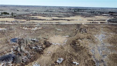
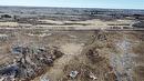
Vacant Land For Sale In Woodridge, Manitoba
$174,900
0 14N Road, Woodridge, MB
  • Advertising
ACTIVE
0 14N Road, Woodridge, Manitoba, R0A 2N0
$174,900

Property Information:

R17//Woodridge/160 Acres currently used as pasture land with potential option of crop land. Some of the land use to be cropped years ago. Located right off a main road. Close to Woodridge! Call for more info! (id:7525)

Building Features:

  • Building Type: No Building

Property Features:

  • OwnershipType: Freehold
  • Property Type: Vacant Land

REALTOR.ca  

Location of 0 14N Road, Woodridge, Manitoba, R0A 2N0

Climate Risk Data

About Climate Risk: Properties are at increased risk of damage from extreme weather due to climate change.
ClimateCheck provides detailed climate risk data for properties now and up to 30 years into the future.

Projected Heat Risk: High

31 hot days expected in 2050

Projected Storm Risk: Significant

11 storms expected in 2050

Projected Heat Risk: High

31 hot days expected in 2050

48/100

High

ClimateCheck®

Current data

This property, 0 14N Road , experiences 7 hot days per year at around 30.6 degrees Celsius.

Projected data

Severe heat risk is expected to increase in this area. In 2050, it is projected that there will be 31 hot days at 34.3 degrees Celsius.

Projected Avg. Temperature

Past
30.6℃
2050
34.3℃

# Hot Days Per Year

Past
7
2050
31

About Heat Risk

Heat risk is the number of extreme heat days experienced each year looking at historical conditions (1980-2005) in your area and taking the 2% of the hottest days and projecting that into the future.

Projected Storm Risk: Significant

11 storms expected in 2050

36/100

Significant

ClimateCheck®

Current data

This property, 0 14N Road , experiences 10 significant 2-day storms per year, with about 241.3mm of precipitation per storm.

Projected data

Severe storms are expected to increase in this area. In 2050, it is projected that there will be 11 significant 2-day storms with 262.1mm of precipitation per year.

Precipitation Per Storm

Past
241.3mm
2050
262.1mm

48-Hour Storms Per Year

Past
10
2050
11

About Storm Risk

Storm risk is the number of high wind, wet or snowy events each year. Climate check looks at historical conditions (1980-2005) in your area, on the days with the top 1% of total precipitation in a year and projected to 2050.

Climate risk data is provided for informational purposes only on Royallepage.ca.
If you have questions or feedback about this data, get help at climatecheck.com.

Environmental Risks provided by ClimateCheck®

Royal LePage does not endorse nor guarantee this information. By providing this information, Royal LePage and its agents are not providing advice or guidance on climate risks. Royal LePage strongly recommends that consumers independently investigate the property’s climate risks to their own personal satisfaction.